To the Ends of the Earth
University of Houston Scientists Leading World-Changing Climate Research

Thwaites Glacier, Antarctica, and Kangerlussuaq, Greenland, are literally a world apart.
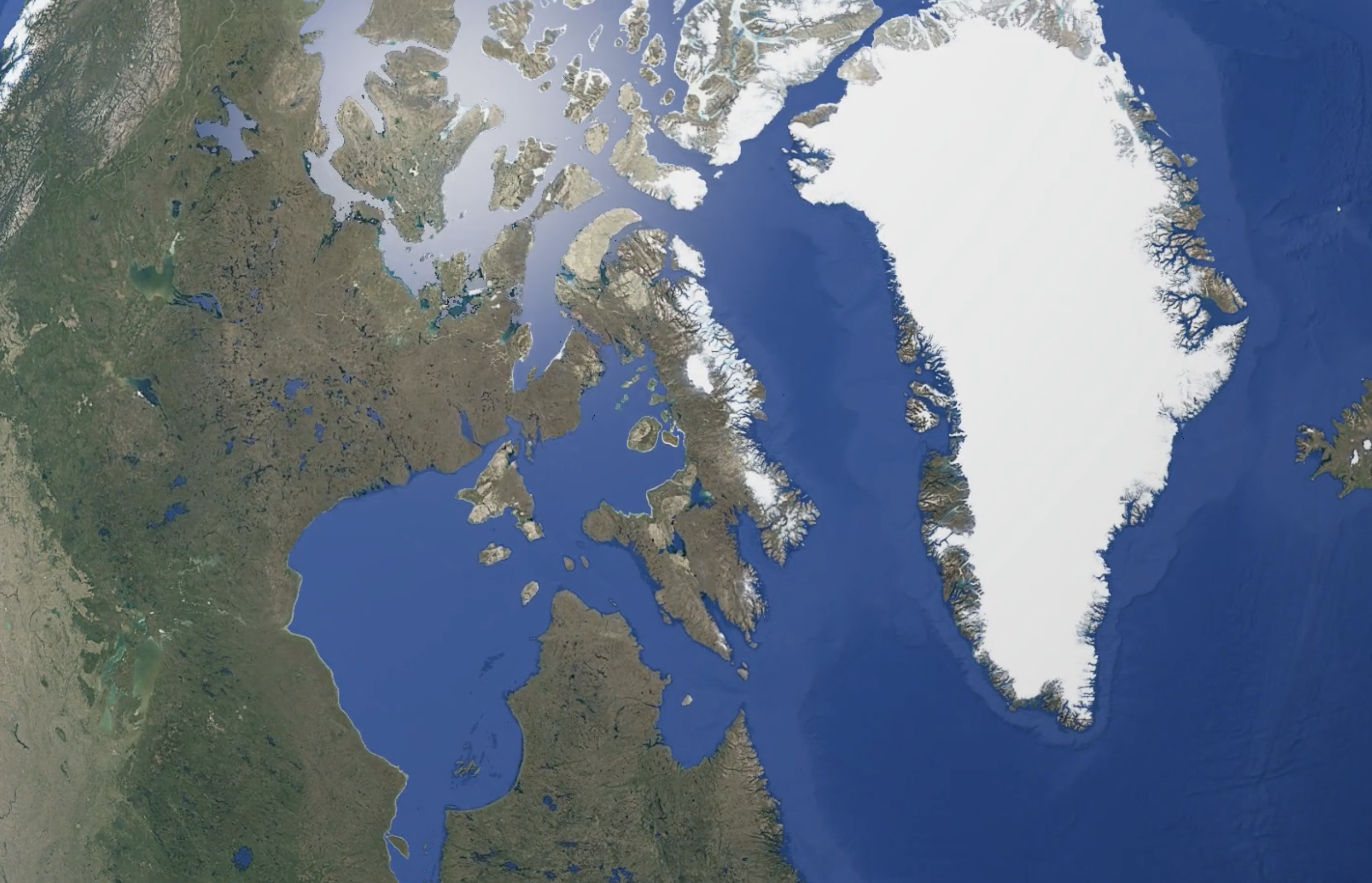
Separated by nearly 11,000 miles, the colossal Thwaites Glacier — the world’s widest — looms over the Southern Ocean near the South Pole while the tiny town of Kangerlussuaq lies at the end of a deep fjord that juts into the Labrador Sea not far from the North Pole.
But these distant outposts have more than just their icy remoteness in common. They are also where scientists at the University of Houston are conducting groundbreaking, world-leading climate research.
Glacial Awareness in Greenland

At the Morphodynamics Lab in the Department of Earth and Atmospheric Sciences at the UH College of Natural Sciences and Mathematics, geomorphology professor Brandee Carlson is working on a complex question: can coastal land-loss from sea level rise be mitigated through a better understanding of how rivers discharge sediment or nutrient-rich sand at their deltas?
UH geomorphology professor Brandee Carlson measuring sediment in Greenland.
UH geomorphology professor Brandee Carlson measuring sediment in Greenland.
To find the answer, Carlson and her team traveled to southwestern Greenland to study how sediment, water and chemical fluctuations coming from melting glaciers to the coast will change as our climate continues to warm. For Arctic rivers, like those in Greenland, sediment discharge is expected to rise 22% for every 2 degrees Celsius of atmospheric warming.
“Understanding where sediments are going is critical to protecting coastal communities around the world, including those along the Texas Gulf Coast. In Greenland, glacial melting discharges a lot of sediment to the coast and it builds land very efficiently, so it's a great example of what works.”
Carlson’s team monitors the effect of sediment delivery on delta growth patterns through field observations and satellite imagery. Previous research has shown while sea levels have fluctuated for most of Greenland, they have remained steady at Kangerlussuaq for nearly 100 years. By comparison, sea levels along the Gulf Coast have risen faster than sediment has been discharged, leading to coastal erosion.
“Kangerlussuaq is the ideal place to study because the relative sea level is constant,” Carlson says. “The coastline builds land through increasing sediment discharge, and knowing how that process works could help engineer solutions to coastal erosion closer to home.”
Caroline Mandujano, who is pursuing a master's degree in Geology at UH, in Greenland.
Caroline Mandujano, who is pursuing a master's degree in Geology at UH, in Greenland.
One of the most rewarding aspects of Carlson’s research in Greenland is the chance to share the experience with her students.
“This was a great opportunity to not only see how a melting ice sheet influenced Greenland’s landscape, but also to better understand the larger changes to our polar regions from rising temperatures and an evolving climate,” says Caroline Mandujano, who is pursuing a master’s degree in geology. “It really is the best classroom on Earth.”
Carlson echoes that sentiment, calling it the perfect blend of education and cutting-edge climate research.
“It’s an excellent place for students to develop an intuition about the processes that sculpt these landscapes, how they’re formed and how dynamic they are, and what they’re learning will have far-reaching, positive implications,” Carlson says. “I think there’s nothing really like it anywhere else.”
The village of Kangerlussuaq in southwestern Greenland served as the base for research operations.
The village of Kangerlussuaq in southwestern Greenland served as the base for research operations.
UH geology professor Brandee Carlson holds a sediment sample collected in southwestern Greenland.
UH geology professor Brandee Carlson holds a sediment sample collected in southwestern Greenland.
UH researchers in Greenland are studying how sediment discharge (lighter-colored area) can mitigate coastal land-loss from rising sea levels.
UH researchers in Greenland are studying how sediment discharge (lighter-colored area) can mitigate coastal land-loss from rising sea levels.
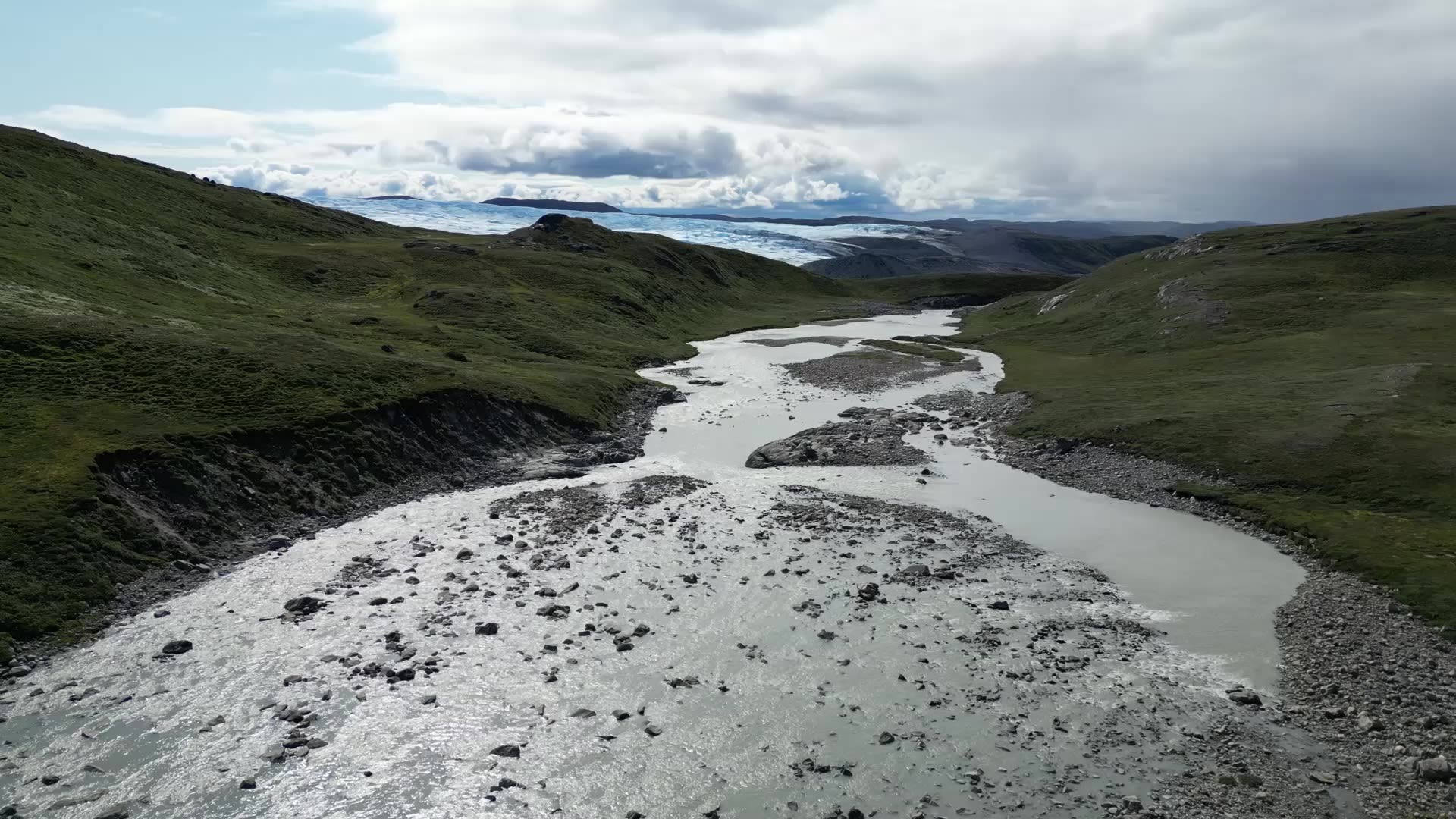
The Qinnguata Kuussua, also called the Watson River, flows from a glacier to the Davis Strait.
The Qinnguata Kuussua, also called the Watson River, flows from a glacier to the Davis Strait.
On Thin Ice in Antarctica

“You think of Antarctica as this gray-skied, snowy-white place, but the color of the landscape was spectacular, with sunrises and sunsets full of bright reds that I had never seen before. Icebergs had so many shades of blue that I never thought were possible.”
Julia Wellner, a geology professor in the Department of Earth and Atmospheric Sciences, has dedicated her career to west Antarctica, and for the past several years, her focus has been Thwaites Glacier, or the “Doomsday Glacier” as it is known in climate circles.
Covering nearly 75,000 square miles on the West Antarctic Ice Sheet, Thwaites is retreating rapidly, losing about 50 billion tons of ice each year and contributing 4% to global sea level rise.
Sunrise over an ice-filled Pine Island Bay in the Amundsen Sea near Thwaites Glacier, Antarctica.
Sunrise over an ice-filled Pine Island Bay in the Amundsen Sea near Thwaites Glacier, Antarctica.
In a recent study, Wellner, the lead U.S. investigator for the Thwaites Offshore Research project, or THOR, and her team determined that significant thinning and retreat of Thwaites began in the 1940s.
“Knowing when this rapid retreat began helps us better understand the glacier’s stability, and that can help inform models of future retreat,” Wellner says. “Ice stability is what drives global sea level. Right now, sea levels are rising about 4.6 millimeters per year, and that will increase if the rate of ice loss from Antarctica increases.”
If Thwaites were to collapse completely, it would raise global sea levels by more than two feet, flooding highly populated coastlines around the world, including those along the Gulf of Mexico.
“We’re already suffering from rapid sea level rise here along the Texas Gulf Coast, higher than the global average,” Wellner says. “And if the global rate continues to increase, obviously it will increase here as well.”
Like the research in Greenland, the Antarctic research involves the study of sediment, but in a different way. Asmara Lehrmann, a second-year geology Ph.D. student at UH and member of Wellner’s THOR team, is looking at Thwaites’ sediment record to better understand the timing of its retreat.
Asmara Lehrmann (left), a second-year geology Ph.D. student at UH, and Michael Comas, who earned his M.S. in geology at UH in 2023, study a sediment core from Thwaites Glacier, Antarctica.
Asmara Lehrmann (left), a second-year geology Ph.D. student at UH, and Michael Comas, who earned his M.S. in geology at UH in 2023, study a sediment core from Thwaites Glacier, Antarctica.
“Thwaites is not only one of the most vulnerable glaciers in Antarctica, but it could also have the largest impact on global sea level rise,” Lehrmann says. “Through our research, we’ve come a long way in understanding what’s driving its instability, but there is still a lot of work to do.”
And while the research was hard work, for Lehrmann, it was also rewarding in more ways than one.
“You think of Antarctica as this gray-skied, snowy-white place, but the color of the landscape was spectacular, with sunrises and sunsets full of bright reds that I had never seen before,” Lehrmann says. “Icebergs had so many shades of blue that I never thought were possible.”
It is that sense of awe that Wellner hopes inspires the next generation of students.
“The best part of my job is that I get to take students in the field with me,” she says. “Antarctica is so much more dynamic than I ever believed when I first went there 25 years ago. Sometimes I wonder what my students will think of this place in another 25 years?”
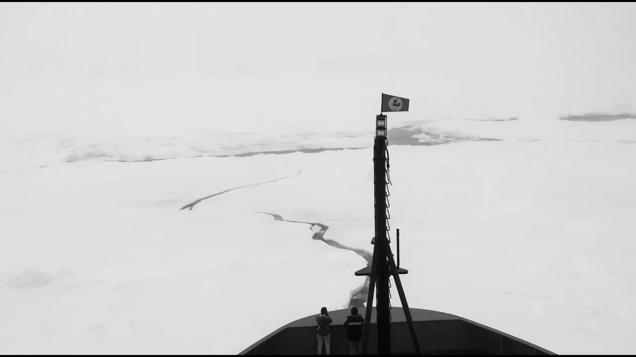
An elephant seal sunbathes on sea ice off Antarctica as the research ship Nathaniel B. Palmer passes by.
An elephant seal sunbathes on sea ice off Antarctica as the research ship Nathaniel B. Palmer passes by.
Emperor penguins frolicking near Thwaites Glacier, Antarctica.
Emperor penguins frolicking near Thwaites Glacier, Antarctica.
A whale breaches off the coast of Antarctica near Thwaites Glacier where UH scientists are leading critical climate research.
A whale breaches off the coast of Antarctica near Thwaites Glacier where UH scientists are leading critical climate research.
Asmara Lehrmann, a second-year geology Ph.D. student at UH, is part of a climate research team on Thwaites Glacier, Antarctica.
Asmara Lehrmann, a second-year geology Ph.D. student at UH, is part of a climate research team on Thwaites Glacier, Antarctica.
The Thwaites Glacier Tongue, a floating, icy extension of Thwaites Glacier in Antarctica, contains enough ice to raise global sea levels by nearly 60 cm.
The Thwaites Glacier Tongue, a floating, icy extension of Thwaites Glacier in Antarctica, contains enough ice to raise global sea levels by nearly 60 cm.
Julia Wellner, geology professor at UH, is leading world-changing climate research on Thwaites Glacier, Antarctica.
Julia Wellner, geology professor at UH, is leading world-changing climate research on Thwaites Glacier, Antarctica.
Research ship Nathaniel B. Palmer passing Thwaites Glacier, Antarctica.
Research ship Nathaniel B. Palmer passing Thwaites Glacier, Antarctica.
Sunrise over an iceberg off the Antarctic coast near Thwaites Glacier where UH scientists are conducting critical climate research.
Sunrise over an iceberg off the Antarctic coast near Thwaites Glacier where UH scientists are conducting critical climate research.
Research Reaching Texas

While Wellner and Carlson have gone to the ends of the Earth for their research, they are also keeping a close eye on what’s happening in the University’s own backyard.
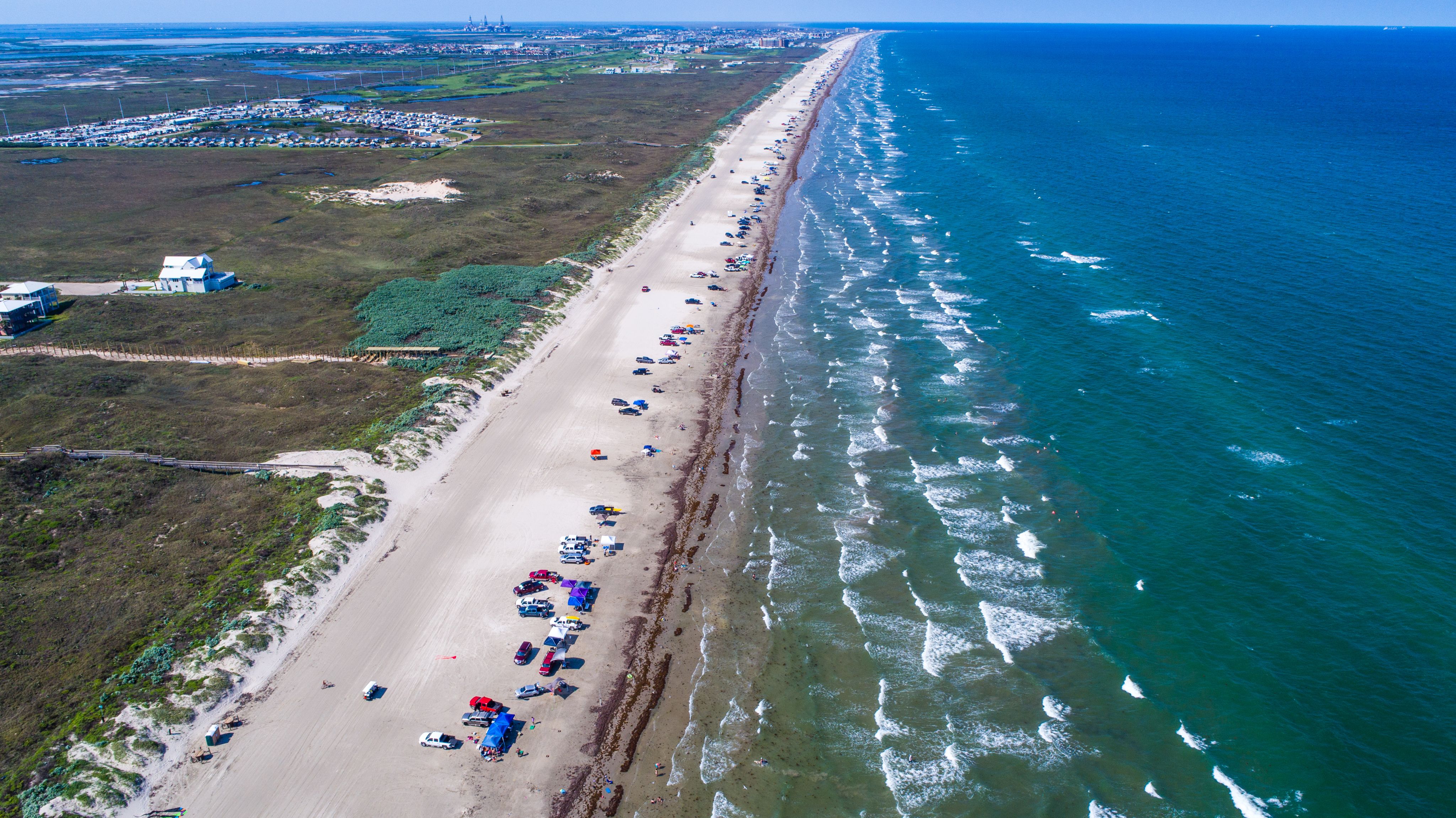
Communities along the Texas Gulf Coast, including Galveston, are already experiencing higher-than-average sea-level rise.
Communities along the Texas Gulf Coast, including Galveston, are already experiencing higher-than-average sea-level rise.
“Neither of us are solely working in these faraway locations,” Wellner says. “We are actively engaged in coastal research here in Texas, as well, and in the communities that our research impacts.”
“I have a current project with the Texas Water Development Board where I’m spending time in three coastal bays watching sea level rise and erosion,” Carlson says. “So what we learned in Greenland is helping us understand what’s happening here.”
UH researchers are applying what they've learned in Greenland and Antarctica to help better understand the impact of rising sea levels along the Texas Gulf Coast.
UH researchers are applying what they've learned in Greenland and Antarctica to help better understand the impact of rising sea levels along the Texas Gulf Coast.
From the Texas coast to the Arctic and Antarctic circles, UH scientists and their students are addressing critical climate challenges on a global scale.
“We love to tell people that the University of Houston has faculty working all over the world, from the mountains to the oceans,” Wellner says. “That’s the nature of being Earth scientists is that we’re out there literally studying the entire planet.”


